Geothermal Systems Protection

Project Overview

Steam rises from multiple geysers scattered across a green, forested landscape with distant hills under a clear sky, suggesting geothermal activity in a national park.As visitors explore Yellowstone, they may not realize they are traveling on one of the world’s largest active volcanoes— an astonishing 30 by 45 miles in size. Heat from this Super-volcano forms the most dynamic geothermal system on Earth with more than 10,000 hydrothermal features. Hot springs, gushing geysers (more than 500), bubbling mud pots, steam vents, and other geological wonders found within Yellowstone’s boundaries played a key role in the creation of the world’s first national park.

The park’s Geology Program plans to study these geothermal systems using infrared (IR) image data which is recognized as the most effective way to capture and monitor changes in hydrothermal areas. IR imagery is captured by flying fixed-winged aircraft over hydrothermal areas twice a year, with visitor-sensitive sites being flown at greater frequencies. The IR images reveal any notable changes for further study by park geologists.

A similar study in Yellowstone ran from 2005-2015. This new program will utilize more modern thermal imaging technology and flights will occur more frequently allowing geologists to quickly analyze and compare data captured at different times (from 10+ years ago and current data that will be captured every 6 months or more). The collection, processing, analysis, and dissemination of this data is a combined effort through the Yellowstone Volcano Observatory (YVO), a consortium of nine state and federal agencies including Yellowstone National Park, USGS, and Montana State University.
How Your Support Helps

Fascinating and dynamic, Yellowstone’s geothermal activity can also pose a threat to visitor safety and the park’s infrastructure. Monitoring the park’s geothermal areas, and how they evolve with time, is fundamental to understanding and preserving them and protecting visitors from their hazards. This important project needs your financial support to kick-off the use and application of this cutting-edge technology.

Donate Today

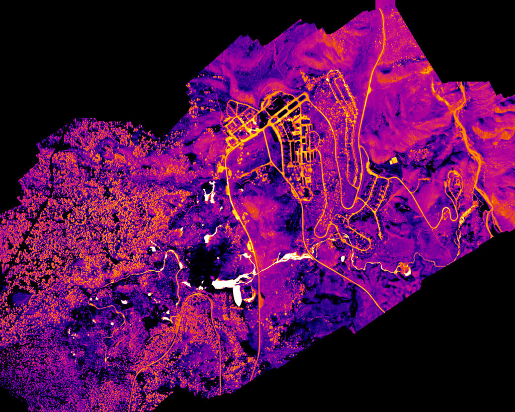
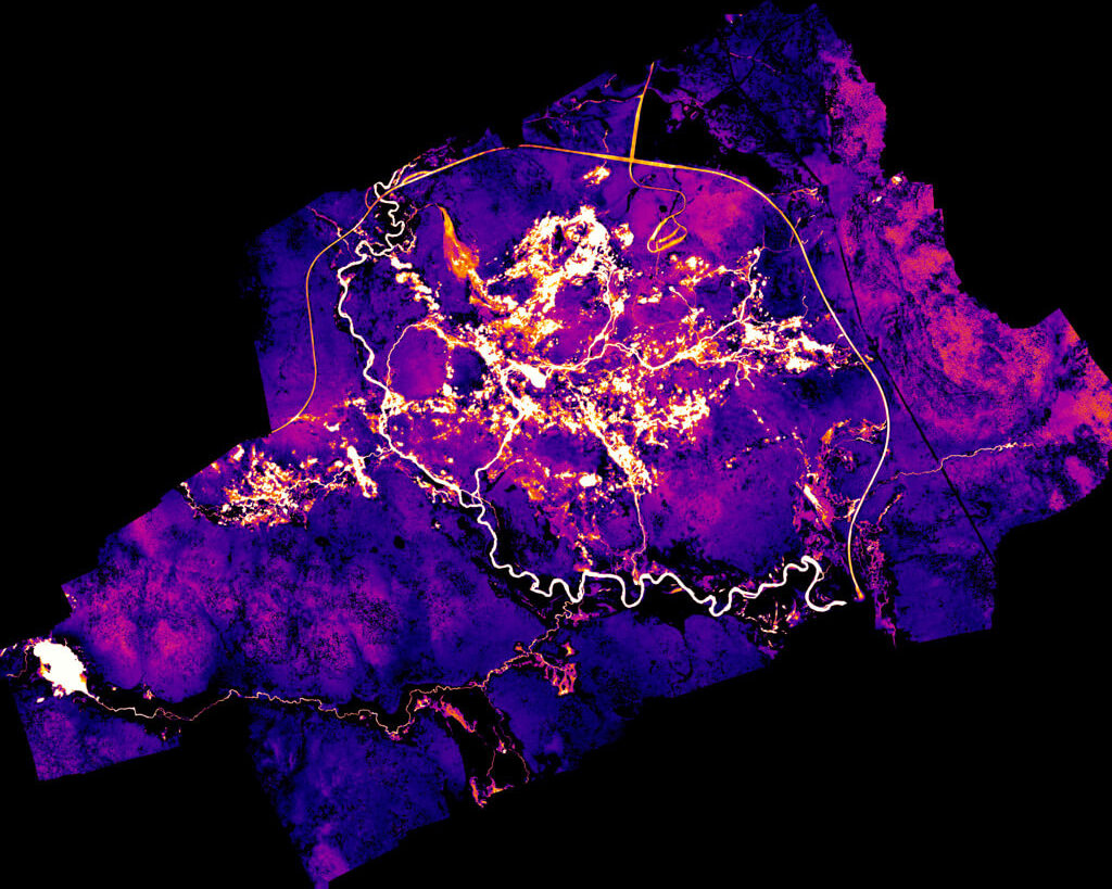
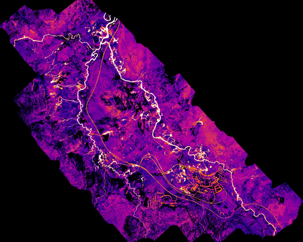
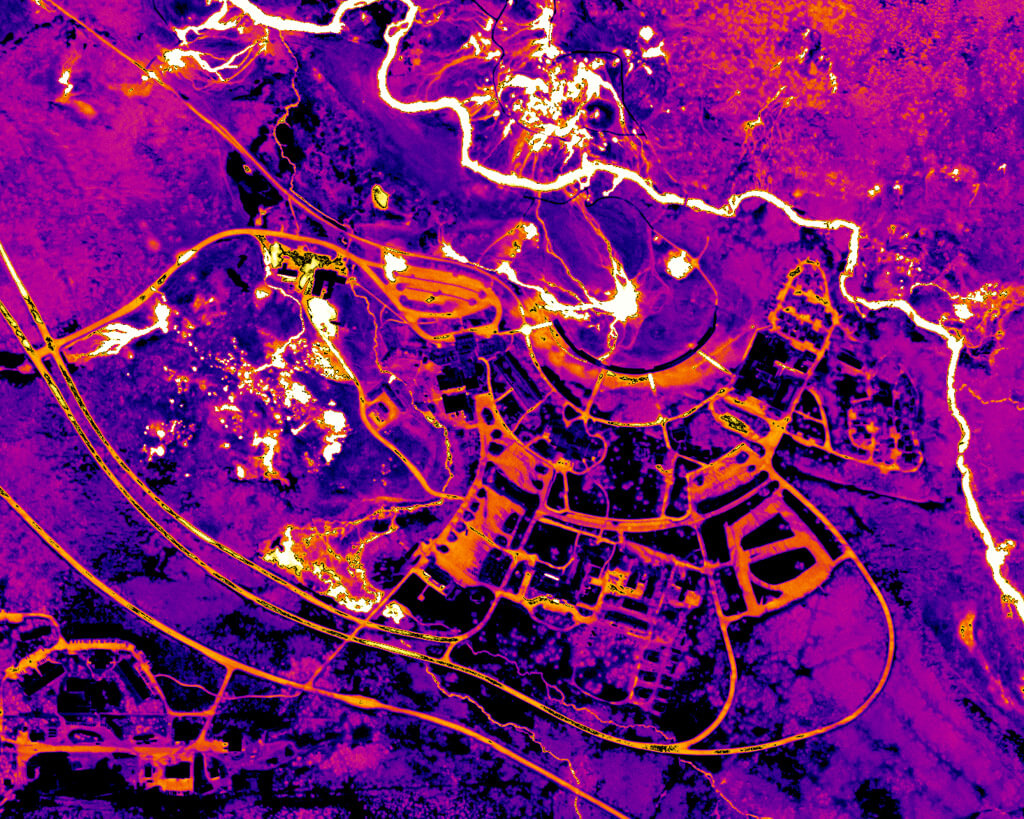
Below are images that were captured at night in 2013 from a fixed wing aircraft using a thermal infrared camera with a zoom lens mounted under the aircraft. The software used assigns colors to the varying degrees of temperatures identified: black to blue to purple for cooler temperatures, magenta to orange for moderate temperatures, and yellow to white for the hottest temperatures.

False-color aerial image showing a mountainous region with winding roads and glowing lines. Shades of purple, pink, and orange highlight elevation and infrastructure against a black background.Image of the Upper Geyser Basin. The Old Faithful complex can be seen on the bottom right.
False-color satellite image of a city with winding roads and rivers, shown in vibrant shades of purple, pink, orange, and yellow, highlighting heat or vegetation differences.Up-close image of the area surrounding Old Faithful.
A thermal satellite image shows a landscape with roads and buildings in bright yellow and orange, surrounded by cooler purple and pink areas representing natural terrain and vegetation.Mammoth Hot Springs
A color-enhanced satellite map shows an urban area with bright white and yellow areas indicating dense regions, surrounded by purple and dark blue areas representing less populated zones. White lines outline major roads and boundaries.Image of part of Norris Geyser Basin, the hottest geyser basin in the park. Bright areas are warmer, dark areas are cooler.
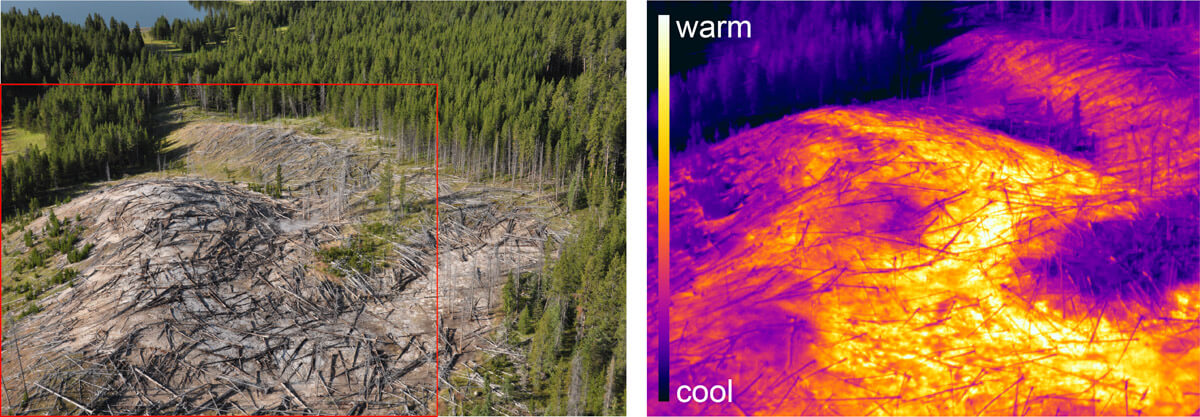
Left: Aerial view of a forest with many fallen trees. Right: Thermal image of the same area, showing warm colors (yellow/orange) on the fallen trees and cool (purple/blue) on the surrounding forest.Arial view of the new hydrothermal area near Tern Lake. The area was recently recognized but emerged in 2021. The image on the Left is a visual representation of the area with a red box outlining the IR image on the right. The IR image illustrates areas of different heat, and the whitest areas are at the boiling point of water at this altitude. This image was taken from a helicopter.

Related content