Because geology involves the study of rocks it is easy to think of it as a static scientific field. But in examining the topography of a place like Yellowstone, where the landscape has remained relatively untouched by humans, it becomes apparent that geology is as dynamic a discipline as any of the natural sciences. The only difference is where biology catalogs the evolution and existence of living things, geology tracks the earth’s changes and movement over time.
Avalanche Peak, NPS / Jacob Frank
The latter is no more apparent than in the greater Yellowstone area, where rocks that were underground during the Precambrian era— from the beginning of earth’s history—can be found on the tops of mountains. Evidence can also be found in the Yellowstone region of ancient seas and mountain ranges that date from as far back as 542 and 80 million years ago, respectively. These mountains, which were the young Rockies, were the result of the North American and Pacific plates—two sections of the earth’s crust and upper mantle—pushing against each other. Then about 30 million years ago, things started moving in the opposite direction and vast expanses of today’s West began stretching along an east–west axis. This pulling apart process increased about 17 million years ago and continues today, creating the modern basin and range topography (north–south mountain ranges with long north–south valleys) that characterizes much of the West, including the Yellowstone area.
Around the same time of this stretching, an intense period of volcanism appeared near the intersection of present-day Nevada, Oregon, and Idaho, creating a 500-mile trail of more than 100 calderas (craters formed by collapsed volcanoes) as the North American plate moved in a southwestern direction over a hot spot—a shallow body of molten rock known as magma—close to the earth’s surface. About 2.1 million years ago, the movement of the North American plate brought the Yellowstone area closer to this hot spot and magma has been near to the surface in the Yellowstone Plateau ever since, creating a geomorphic landform shaped by episodes of volcanic activity, including three major eruptions.
Sheepeater Cliff, YF / Matt Ludin
The first of these eruptions took place right about the time the area moved over the hotspot. One of the largest volcanic eruptions ever known, it covered 5,790 square miles with ash. A second, smaller eruption occurred around 1.3 million years ago and a third about 640,000 years ago. This last one spewed volcanic ash as far away as Kansas and Nebraska and created the Yellowstone Caldera, the 30-mile by 45-mile-wide rim that is still visible in parts of the park today. In fact, from Sheepeater and Obsidian cliffs in the north to Lewis Falls in the south, almost everywhere you look in Yellowstone there is visible evidence of past volcanic activity.
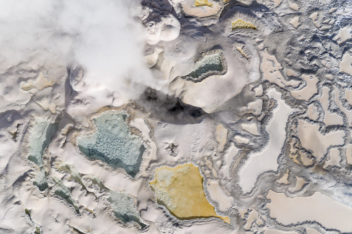
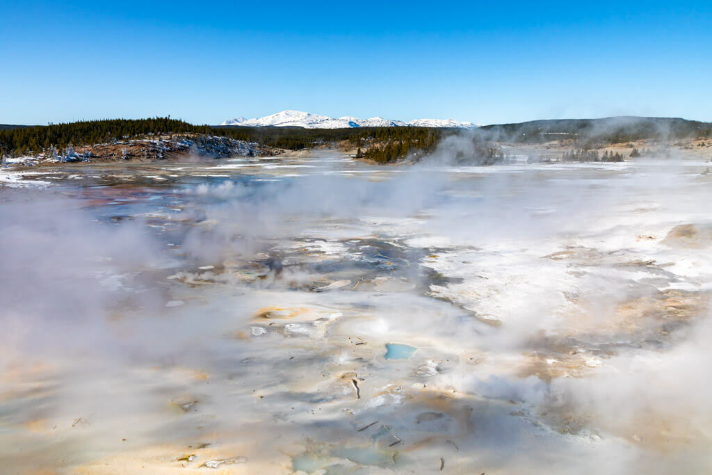
While the last time lava flowed was 70,000 years ago, Yellowstone National Park still sits over the hot spot and is therefore considered an active volcano. Evidence of this today comes in many forms. The most visible reminders are the some 10,000 thermal features that call parts of the park and its surroundings home. In these areas, water from rain or snowmelt seeps down through cracks in the earth’s crust where it is superheated by the hot spot a few miles under the surface.
This heating process causes the water to rise in the wonderful displays of bubbling, spouting water, steam and mud that we’ve all come to expect when we visit places like the Mammoth Terraces, Old Faithful, and the Norris Geyser Basin. Additional indications of volcanic activity can be harder to spot, like the two resurgent domes—one near Sour Creek and the other at Mallard Lake—which both lift up and subside as magma or hydrothermal fluids upwell or subside beneath them.
Norris Geyser Basin, YF / Matt Ludin
Still other volcanic activity cannot be seen but felt as the Yellowstone area is home to approximately 700-3,000 earthquakes each year. Registering above 7 on the Richter scale, the 1959 Hebgen Lake earthquake that killed at least 28 people and caused a massive landslide and measurable changes to Old Faithful Geyser and other hydrothermal features was probably the most notable earthquake in the region.
In recent years, Yellowstone has been home to earthquake swarms, a myriad of small seismic activity that takes place in the same area in a short period of time. In December 2008, a swarm under Yellowstone Lake produced 500 earthquakes while in September 2013 three different swarms combined for a total of 130 earthquakes in the Old Faithful area. Reaching high magnitudes of 3.9 and 3.6 respectively, very few of these tremors were felt by humans and neither of these swarms caused any changes to the park’s hydrothermal activity.
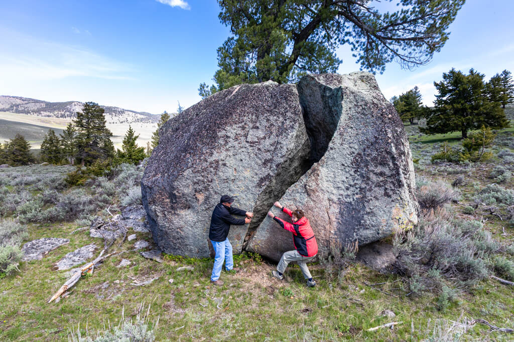
Glacial boulder near Specimen Ridge, YF / Matt Ludin
While it is easy to see why fire was and is a key element in the development of Yellowstone’s landscape, ice too has had a sizable impact on what we see today when we look out our car windows. At varying times during the Pleistocene Ice Age, which lasted from about 2.6 million years ago until about 13,000-14,000 years ago, glaciers upwards of 4,000 feet thick covered much of the Yellowstone area. Large rivers of ice, the glaciers eroded and sculpted the land underneath them, thereby playing a role in shaping the park’s mountains, fertile basins, canyons and lakes. When these glaciers melted they also helped to create hills known as glacial moraines, kettle ponds, and much of the park’s river system that we know today.
Because what we see in present day Yellowstone is the result of geology’s gradual process—nips and tucks made to the Earth over spans of time too extensive to even comprehend—we sometimes forget that time has not stopped and what we see will not be here forever. The same movement that slid Yellowstone over the hot spot will one day shift an entirely different section of earth, probably a swath of land near the Beartooth Mountains around Cooke City, Montana, over the big magma chamber currently under the park. If pressures inside the earth are sufficient, this new cover may then undergo an enormous volcanic explosion of its own, afterward collapsing to form yet another caldera, starting a new cycle of geologic evolution.
Feature Image: Old Faithful close-up aerial image for scientific purposes (Taken by NPS, drones not permitted by public)
RELATED | YELLOWSTONE FOREVER PARK STORE
For information on Yellowstone’s geology and more, check out these resources available at Yellowstone Forever Park Stores and online. All purchases help support critical projects and programs in Yellowstone National Park.


Comments are closed.