Have you ever experienced an earthquake in Yellowstone? You might say no, but chances are at least one small earthquake occurred during your visit. On average, approximately 1,000 to 3,000 earthquakes take place each year in the Yellowstone area. Most are too small to be felt, but a few—like the famous quake of 1959—are exceptions.
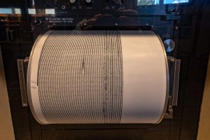
An active seismograph at the Quake Lake Visitor Center
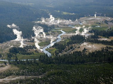
Yellowstone is one of the most seismically active areas in the United States. The park is contained within the Intermountain Seismic Belt, a zone of earthquake activity that runs north-south, from Montana through Wyoming, Idaho, Utah, Nevada, and Arizona. Yellowstone is also an active volcano, and surface features such as its famous geysers and hot springs are direct results of the region’s underlying volcanism.
The combination of tectonic and volcanic activity often results in earthquakes, during which rock fractures along fault lines that have become stressed beyond their breaking point. Energy is then released as shock waves, or seismic waves, that reverberate and travel at high speeds throughout the surrounding rock.
Earthquakes do offer some benefits; if it wasn’t for the many small quakes, Old Faithful and other geysers and hot springs could become dormant. In Yellowstone, earthquakes help to maintain hydrothermal activity by keeping the “plumbing” system open. Without periodic shaking from earthquakes, the small fractures and conduits that supply hot water to geysers and hot springs might be sealed by mineral deposits—perhaps permanently.
Monitoring Earthquakes in Yellowstone
The largest Yellowstone earthquake since the early 1980s occurred on March 30, 2014. The magnitude 4.8 quake was centered four miles outside Norris Geyser Basin and was felt throughout parts of Montana and Wyoming.
While mostly invisible to the casual visitor, an extensive geological monitoring system is in place within Yellowstone. The park’s earthquake activity is tracked around the clock by the University of Utah Seismograph Stations, a member of the Yellowstone Volcano Observatory (YVO), a cooperative effort of the National Park Service, the U.S. Geological Survey (USGS), and the University of Utah.
In fact, USGS Scientist-in-Charge, Mike Poland, provides video updates on the Yellowstone Volcano including the latest news and information on earthquake activity from the previous month.
According to seismologists from the University of Utah, which operates 26 seismograph stations throughout the park, earthquake swarms are relatively common in Yellowstone. A swarm is a series of small earthquakes in a localized area—sometimes more than 100 in a single day!
The largest known swarm occurred in 1985, with more than 3,000 earthquakes recorded during three months along the West Entrance road. More recently, during the winter of 2010, nearly 2,000 quakes were recorded between Old Faithful and West Yellowstone.
This comprehensive monitoring system helps scientists map and create a better understanding of the sub-surface geology around and beneath Yellowstone.
Read part II of this series,Yellowstone Volcano Revealed.
The Night the Mountain Fell
 “We had just got to sleep when we were awakened by a tremendous roar. I could hear trees splitting and falling. It got terribly quiet, and then the screams began.” -Bill Conley, 1959 earthquake survivor
Earthquakes less than a magnitude 3.0 are not usually felt by people. It typically takes an earthquake of magnitude 4.0 or greater to cause structural damage, and a magnitude 6.5 earthquake to cause the surface of the ground to rupture. Though earthquakes greater than magnitude 6 are uncommon in Yellowstone, some have occurred.
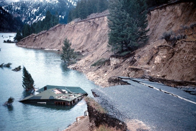
The most famous, and most tragic, earthquake in the Yellowstone area happened 57 years ago today. The 7.3-magnitude quake, which caused 18 miles of surface faulting and was felt across 600,000 square miles, decimated a popular campground at the height of tourist season.
On the evening of August 17, 1959, around 250 visitors slept throughout the Madison River canyon near Hebgen Lake, just west of Yellowstone. Some bedded down in private cabins and resorts, others at Forest Service campgrounds or makeshift campsites along the roadsides.
Just before midnight, an earthquake jolted the travelers from their sleep. A short time later a wall of water hurdled over Hebgen Dam and raged down river. And then, the unthinkable happened: an enormous section of canyon wall broke loose and crashed down just below Rock Creek Campground.
 “It was a night of terror and chaos. Scattered families fled through the darkness. Those who could, scrambled for high ground as the newly-formed lake rose to swallow their campsites and cars. Others, trapped by the rising water, screamed for help. It would be many long, dark, and terrifying hours before dawn—and it would be many days before it was known just who had lived, and who was lost.” – U.S. Forest Service interpretive exhibit
Ultimately, it was learned that 28 people were killed, 19 of whom are still entombed within the landslide debris.
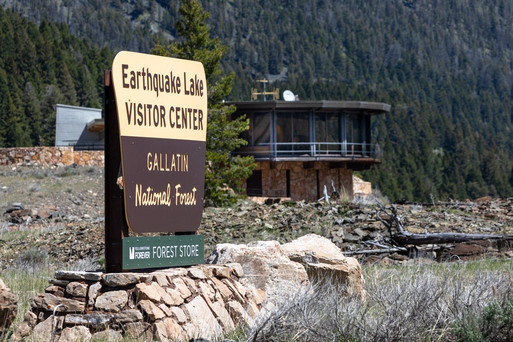
A visit to “Quake Lake,” as it is now known, is an easy side trip during a visit to Yellowstone. The Earthquake Lake Visitor Center, open late May through late September, sits just above the lake formed by the Hebgen Lake earthquake. It offers interpretive displays, a working seismograph, walking path to a Memorial Boulder, scheduled movies and talks, and a Forest/Park Store operated in partnership with Yellowstone Forever.
Learn more about Earthquakes in Yellowstone:
- Yellowstone Volcano Observatory
- Read more about Yellowstone earthquake science, seismograph stations, and more.
- View photos, a video, and more at the Madison River Canyon (“Quake Lake”) Earthquake virtual exhibit.
Photos, top to bottom: Geyser basin aerial – NPS photo; Highway 287 slumped into Hebgen Lake – USGS; Quake Lake road sign – YF / Matt Ludin; Earthquake damage at Gibbon Falls, Yellowstone, 1959 – NPS Photo.
Comments are closed.